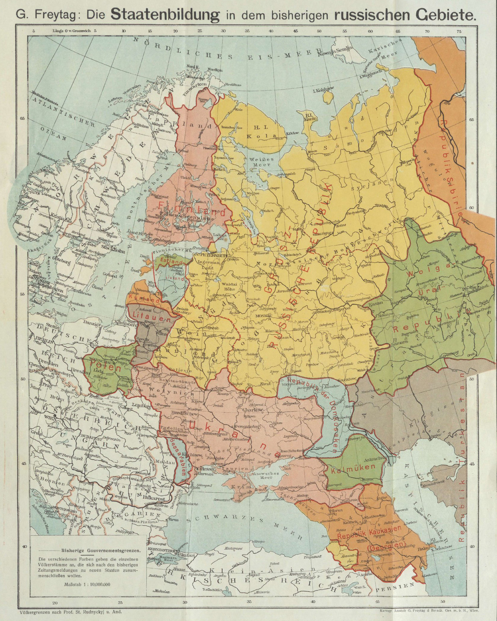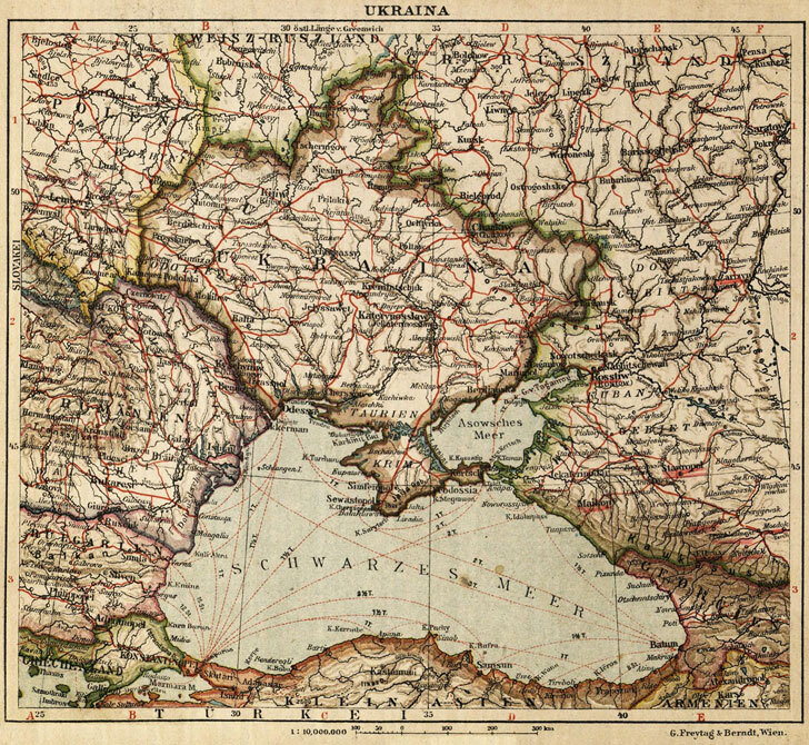
The map "Die Staatenbildung in dem bisherigen russischen Gebiete" (The State Formation in the Former Russian Territory) published by G. Freytag & Berndt in Vienna in 1918 provides a crucial cartographic record of Ukrainian territorial claims during the pivotal year of independence. Published at the height of revolutionary upheaval following the Bolshevik Revolution and the Treaty of Brest-Litovsk, this map captured a moment when the collapse of the Russian Empire seemed to make Ukrainian statehood genuinely achievable.
The year 1918 was extraordinary for Ukrainian aspirations. The Ukrainian People's Republic, proclaimed in January 1918, sought international recognition and defined its territorial boundaries. The map likely reflected the maximalist claims of the Central Rada, the Ukrainian parliament, which envisioned a state encompassing virtually all Ukrainian-speaking territories of the former Russian Empire.
These territorial claims extended across a vast expanse. The northern boundary followed roughly through the Polesian region, incorporating mixed Ukrainian-Belarusian areas. Eastward, the claims reached into the Sloboda Ukraine around Kharkiv and extended toward the Don Cossack territories, where Ukrainian settlement was historically significant. The southern boundary naturally included the entire northern Black Sea littoral, from Bessarabia to the Kuban, encompassing vital port cities.
The western frontier presented the most complex questions. While the map showed Ukraine's eastern territories carved from the Russian Empire, the status of Eastern Galicia, then still technically part of Austria-Hungary, remained ambiguous. Ukrainian nationalists hoped to unite all Ukrainian lands, but the Habsburgs' continued existence in 1918 complicated such claims.
The Vienna publication context is particularly significant. Austria-Hungary and Germany had recognized Ukrainian independence through the Treaty of Brest-Litovsk in March 1918, making the Central Powers the first states to acknowledge Ukrainian sovereignty. A Viennese cartographic firm producing this map in 1918 was thus documenting an allied state's territorial claims, lending them a degree of international legitimacy.
The map's title, emphasizing the "state formation" in former Russian territory, reflects the revolutionary moment's fluidity. Multiple nationalisms were simultaneously asserting territorial claims across the former empire's western borderlands. Ukraine was not alone; Finnish, Baltic, Polish, and Caucasian national movements were making similar assertions.
This cartographic representation immortalized a brief historical moment when Ukrainian independence seemed secured by German and Austrian military power. Within months, the Central Powers' November 1918 collapse would shatter these arrangements, plunging Ukraine into renewed civil war and ultimately Soviet incorporation. The map thus documents both the apex of Ukrainian territorial ambitions and the fragility of their realization.