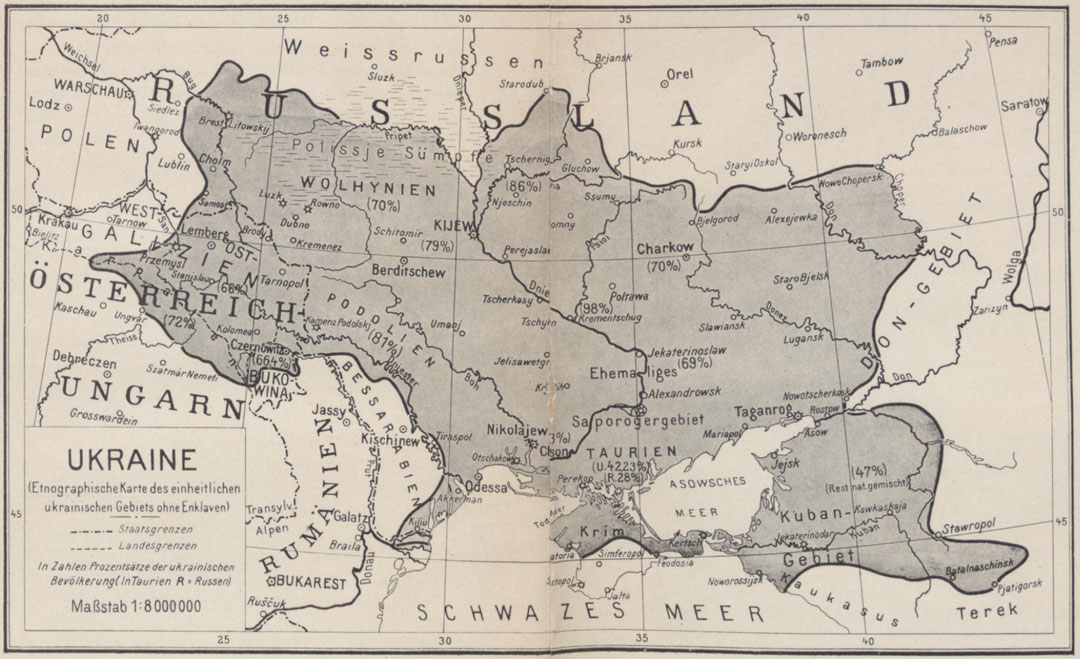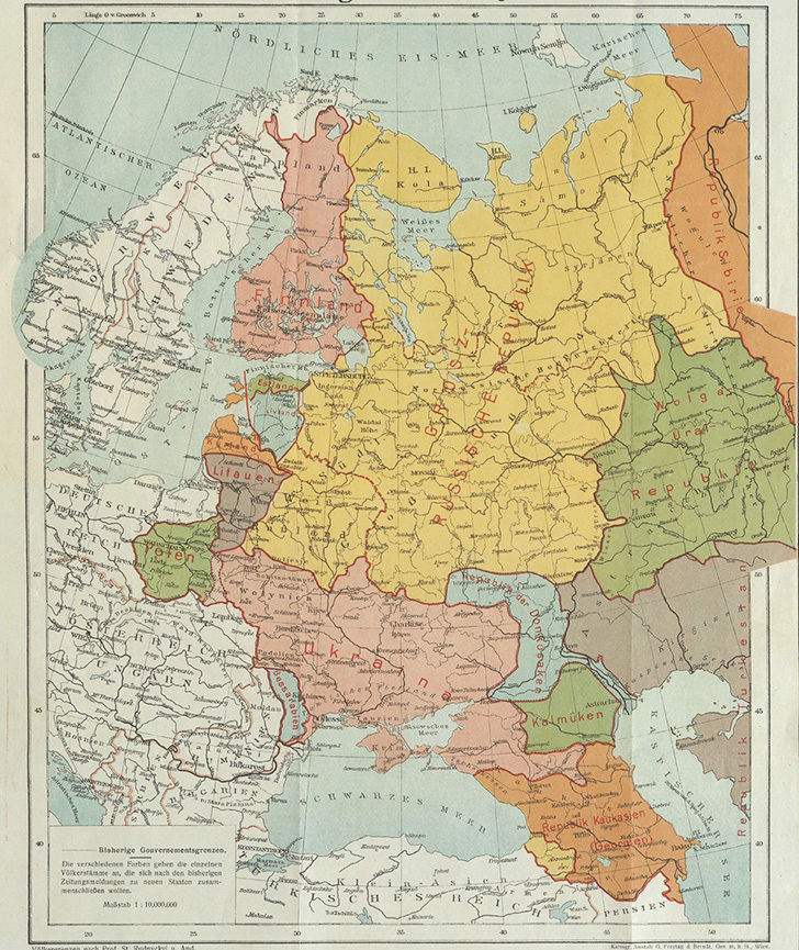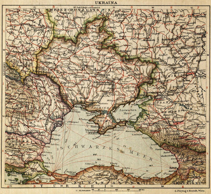
The territorial aspirations of Ukrainian nationalism in the early twentieth century found cartographic expression in various works, including the map published by Karl Lewicky (Kost Levytsky) in Stuttgart in 1915. These visions emerged from a complex interplay of ethnographic arguments, historical claims, and political ambitions that had been developing throughout the nineteenth century.
Ukrainian nationalist intellectuals based their territorial claims primarily on ethnographic and linguistic distributions. They envisioned a Ukrainian national territory extending from the Carpathian Mountains in the west to the Don River region in the east, and from Polesia in the north to the Black Sea coast in the south. This expansive conception included not only the core Ukrainian-speaking regions of the Russian Empire's southwestern provinces but also substantial areas where Ukrainians (or "Little Russians" as they were often called) formed significant minorities or mixed populations.
The western boundaries of these claims encompassed Eastern Galicia, which was then under Austrian rule, including the city of Lviv (Lemberg/Lwów). Nationalists argued that this region's Ukrainian population warranted inclusion in any future Ukrainian state. The Northern Bukovina and Transcarpathia were similarly incorporated into these visions based on the presence of Ruthenian-speaking populations.
Eastward, the claims extended into areas that would later become contentious, including the Kuban region and parts of the Don Cossack territories, where Ukrainian settlement and linguistic influence were historically present. The southern claims naturally included the entire northern Black Sea coast, with cities like Odessa occupying an ambiguous position in nationalist discourse due to their cosmopolitan character.
Lewicky's 1915 map must be understood in its wartime context. Published in Germany during World War I, it served specific political purposes related to the Central Powers' strategy of weakening the Russian Empire by encouraging its national minorities. The map likely represented a maximalist vision intended to garner support from Germany and Austria-Hungary.
These early territorial conceptions proved enormously consequential. They influenced the brief independence period of 1917-1920, shaped Soviet administrative boundaries, and continue to resonate in contemporary political discussions. The claims reflected not merely ethnic distributions but also economic considerations: access to agricultural lands, industrial regions, and maritime ports.
However, these nationalist visions often glossed over the region's genuine multiethnic complexity, where Ukrainians, Russians, Poles, Jews, Romanians, and others lived intermixed, making any ethnographic boundary fundamentally contested and problematic.