
This section presents a collection of original historical maps of Ukraine, illustrating the evolution of the Ukrainian realm, with its territories and borders, from early times to the Russian aggression. These maps highlight how historical events and trends, political reforms, territorial reorganizations, and regional identities shaped the history and historical geography of the Ukrainian lands over time. Designed for educational use, the collection provides accessible visual resources suitable for classroom teaching, school projects, and introductory historical study.
See also :
Historical Maps of Ukraine — curated links to historical maps and resources covering Ukrainian history;
Historical Maps of Russia — curated links to historical maps and resources covering Russian history;
Historical Maps of Europe — major political and territorial changes across the continent;
Historical Maps of the U.S.A. — major political and territorial changes of the American history;
Historical Maps of Canada — provinces, territories, and colonial borders.


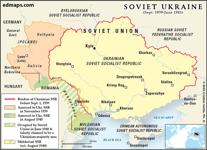
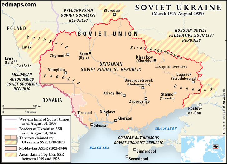


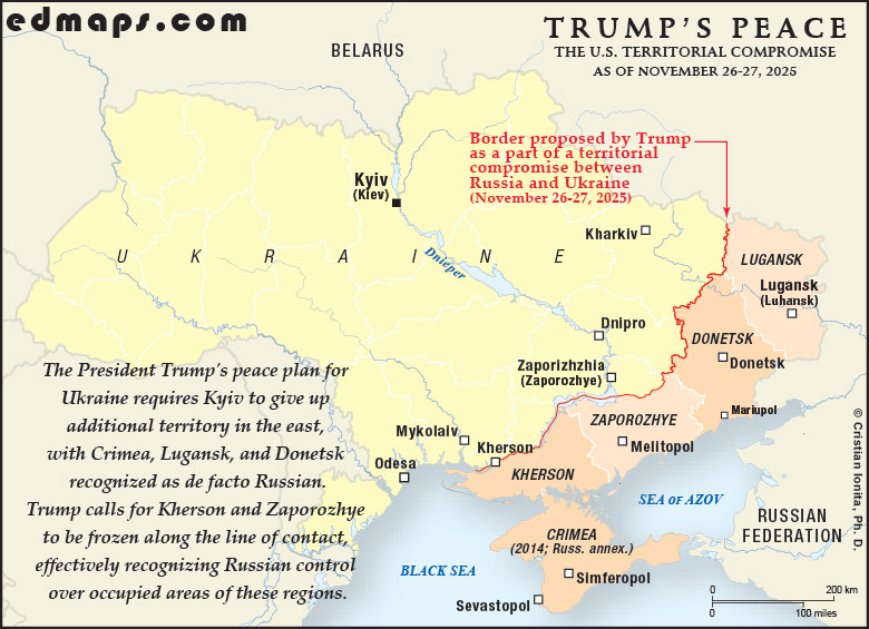

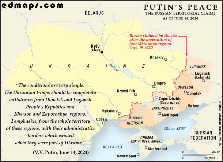
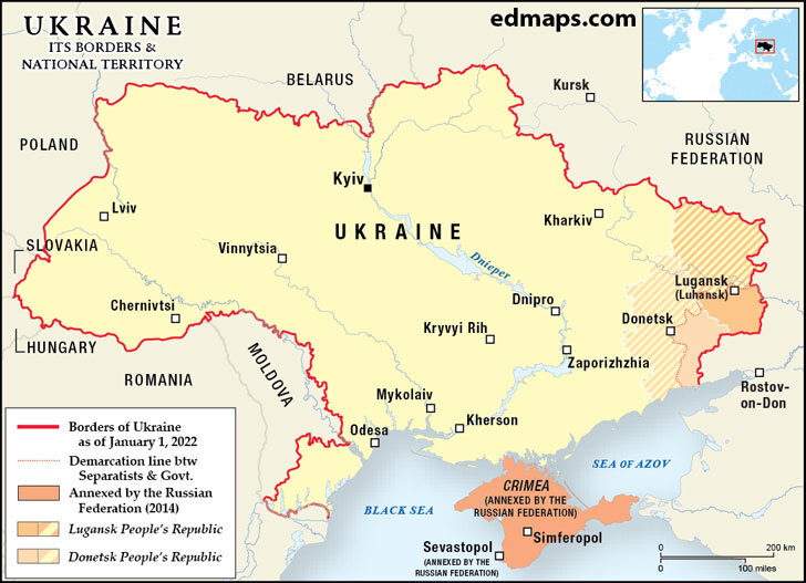
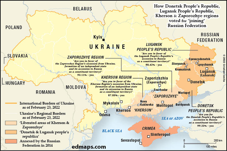
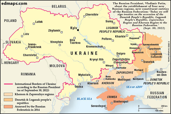

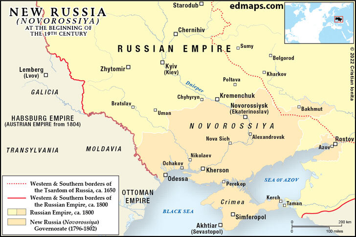
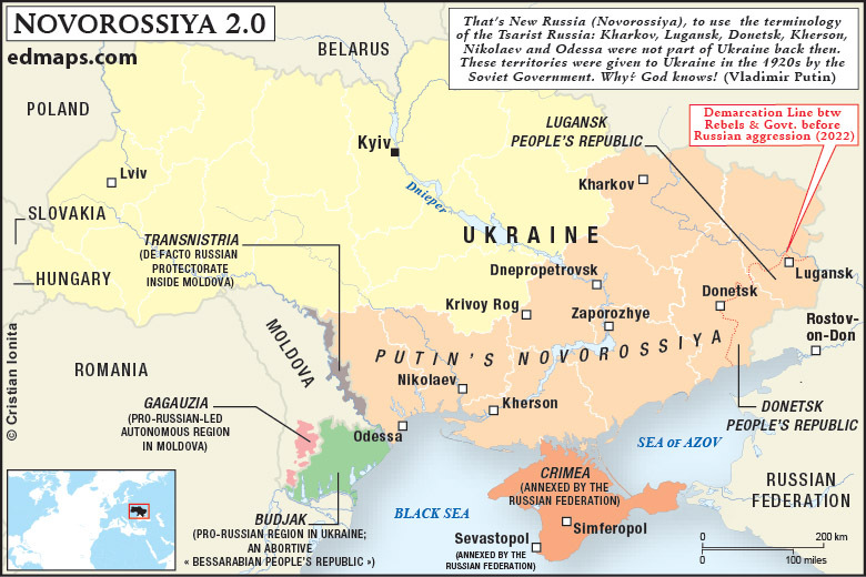
Sources, Methodology & Educational Use: The maps presented on this page are original creations produced for edmaps.com by Dr. Cristian Ionita. Each map is based on verified historical data relating to the territorial evolution, administrative structures, and political history of Ukraine. The maps are designed according to established practices in historical cartography, including source analysis, period contextualization, and visual clarity. The collection is curated to support teaching, learning, and public understanding of Ukrainian history, and is intended for educational and non‑commercial use.
edmaps.com — Historical Cartography for Education
edmaps.com provides original maps and curated historical maps designed to support teaching, learning, and public understanding of territorial evolution and administrative history. The original maps are created by Dr. Cristian Ionita, and all curated maps are selected from public archives, historical collections, and private holdings, and are presented for educational and non‑commercial use.
© Cristian Ionita. All rights reserved.
Website: https://edmaps.com — Contact: info@edmaps.com