
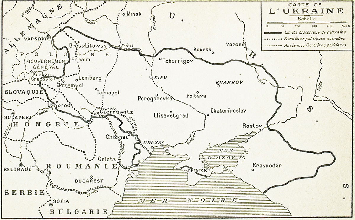
The territorial schema reproduced by Jacques Benoist‑Méchin in "L’Ukraine des origines à Staline" (Paris, Albin Michel, 1941) reflects a markedly different cartographic imagination from the administrative boundaries asserted by Ukrainian political actors during the revolutionary years. Rather than depicting a functioning state or a legally grounded claim, the map presents a synthetic vision of the Ukrainian nation as conceived within interwar nationalist discourse, shaped by ethnographic arguments, historical retrospection, and the geopolitical anxieties of the late 1930s.
Benoist‑Méchin’s outline encompasses a broad arc of territory stretching from the Carpathians to the Don basin, integrating regions that had never formed a single political unit but were understood by nationalist writers as belonging to a continuous Ukrainian ethnolinguistic zone. Galicia, Bukovina, and Transcarpathia appear alongside the core lands of the former Russian guberniyas, while the steppe districts of the Black Sea littoral and the approaches to the Caucasus are included as extensions of a historical frontier shaped by Cossack settlement and imperial contestation. The resulting configuration is less a political boundary than a cultural‑historical construct, projecting a unified national space across multiple imperial legacies.
The map’s outer limits thus exceed any contemporary administrative reality, enclosing territories under Polish, Romanian, Soviet, and even nominally autonomous control. By plotting this maximalist perimeter, Benoist‑Méchin translates an ideological claim into cartographic form, presenting the Ukrainian nation as a trans‑imperial continuum whose fragmentation is attributed to external domination rather than internal diversity. For readers in 1941, this juxtaposition of present borders and imagined national extent visually stages the unresolved question of Ukrainian unity, framing territorial loss and partition as the central drama of the country’s modern history.
Read in context, the map functions less as a record of political fact than as a window onto the nationalist narratives circulating in Europe on the eve of the Second World War: expansive, retrospective, and designed to assert a coherent national geography where none yet existed.


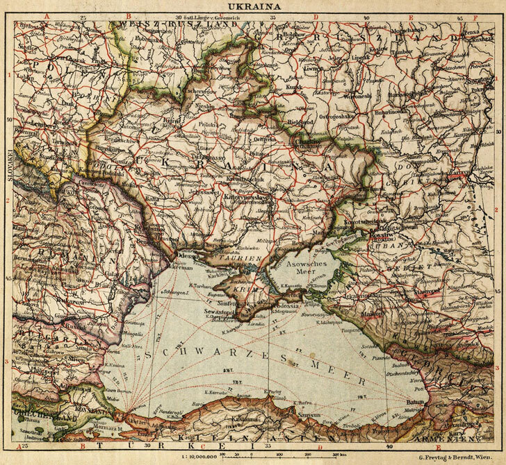
edmaps.com — Historical Cartography for Education
edmaps.com provides original maps and curated historical maps designed to support teaching, learning, and public understanding of territorial evolution and administrative history. The original maps are created by Dr. Cristian Ionita, and all curated maps are selected from public archives, historical collections, and private holdings, and are presented for educational and non‑commercial use.
© Cristian Ionita. All rights reserved.
Website: https://edmaps.com — Contact: info@edmaps.com